Research reveals scale of potential for rooftop solar in Hampshire
New mapping tool reveals ‘hotspots’ for solar initiatives but policies are needed to make the most of potential.
New modelling from the University of Southampton has revealed the huge potential for rooftop solar in Sussex and Hampshire.
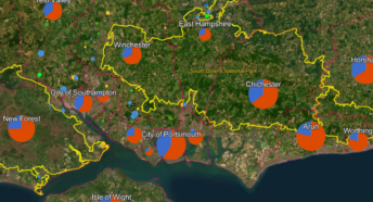
The project has mapped and analysed every rooftop within East Sussex, West Sussex, Brighton & Hove and Hampshire to assess its potential for PV solar installation.
Researchers considered the size, orientation, slope and potential overshadowing to determine whether solar installation would be effective.
A publicly available map allows local authorities, building owners, community groups and the solar industry to identify potential solar “hotspots” within a specific area.
“We are calling on the Government and councils to seize the potential of rooftop solar and help power the UK on sunshine. By maximising the amount of solar we put on rooftops and car parks we can keep as much land free as possible for wildlife, leisure, farming, flood protection and so much more. Ed Miliband has borrowed the CPRE campaign call for a “rooftop revolution” but now we need to see the policies in place to make it happen.”
Almost half of rooftops (45%) in Sussex and Hampshire have sufficient sunlight for solar PV installation to be effective. This gives a theoretical capacity of 2,000 MWp for Hampshire and 1,950 MWp for Sussex.
Sussex and Hampshire represent roughly 6% of England’s area and population. This suggests, if results were scaled up proportionally, England alone has a theoretical rooftop potential of 66GW. As both areas are relatively rural, the national potential could be even higher.
The “bottom-up” roof-by-roof approach validates earlier England-wide research which highlighted how rooftop solar could help meet the Government’s 70GW by 2035 target. However, changes in policy are needed to make the most of this potential.
Read 10 recommendations for Government and local authorities in Policy Brief – Getting solar off the ground
View the solar mapping tool
- Click ‘Enter’ on the first Disclaimer/Acknowledgements screen.
- Down the top right hand side of the map screen are 4 boxes.
- The bottom one is a search icon. Click this and use the pop-out menu to find the location you want by entering, e.g. a postcode.
- The top box is ‘layers’. Click this and use the pop-out menu to ensure that the ‘Sussex rooftop potential view’ is visible (it should show an eye next to it, not a crossed-out eye). The data (coloured blocks) for individual streets/buildings should appear.
- Then select the second box from the top – this gives you the ‘legend’. Scroll down the pop-out menu to find a key for the colours, which should show the total rooftop potential for a street or building.
Watch the video of the launch of the research.
See presentation from the launch of the research: Rooftop solar launch slides
The policy brief and mapping tool are the result of a collaboration between the University of Southampton, CPRE Sussex and CPRE Hampshire. The project was funded by the Centre for the South’s New Things Fund


